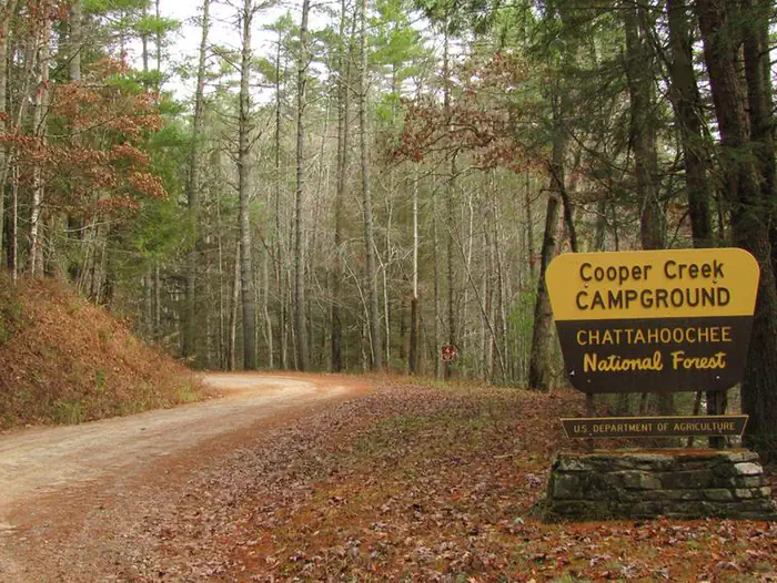
Cooper Creek Campground
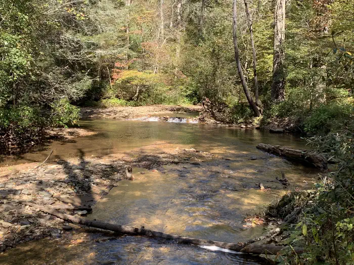
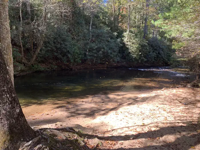
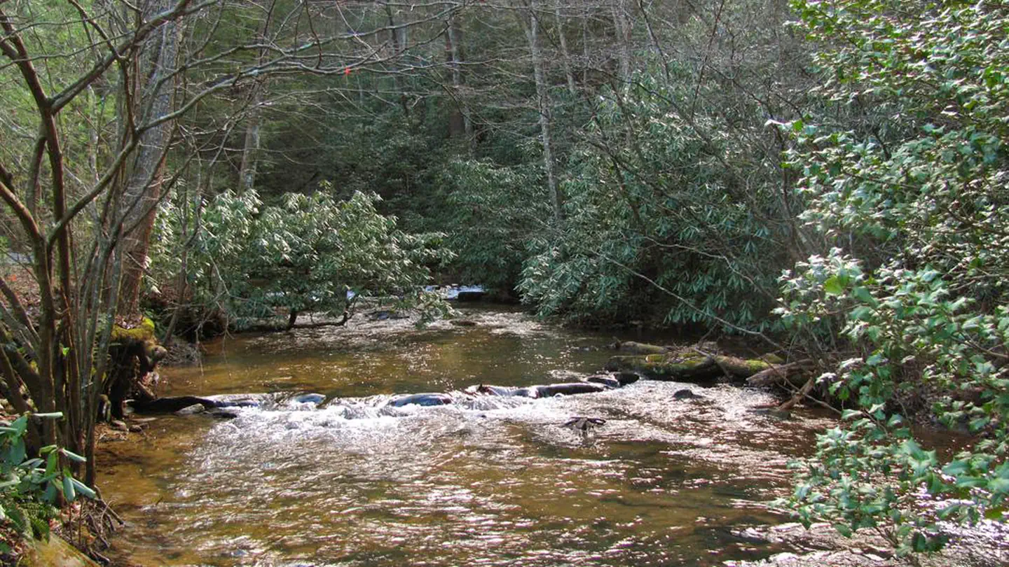
Cooper Creek Campground is located in the Chattahoochee-Oconee National Forest along the banks of Cooper Creek in the North Georgia Mountains. The Campground offers many recreation activities including camping, hiking, trout fishing, and hunting. The campground is well kept and is a nice place for just a weekend getaway or an extended stay. Most of the campsites are fairly spaced apart so the privacy level is decent which makes for and enjoyable time. This Recreation area is well known for great trout fishing year-round and you can fish up and down the main creek or take the numerous trails along the bank of the creek if you’re not having any luck at the campground.
More like this: reservable in Georgia · pets allowed in Georgia
Check availability on Recreation.gov ↗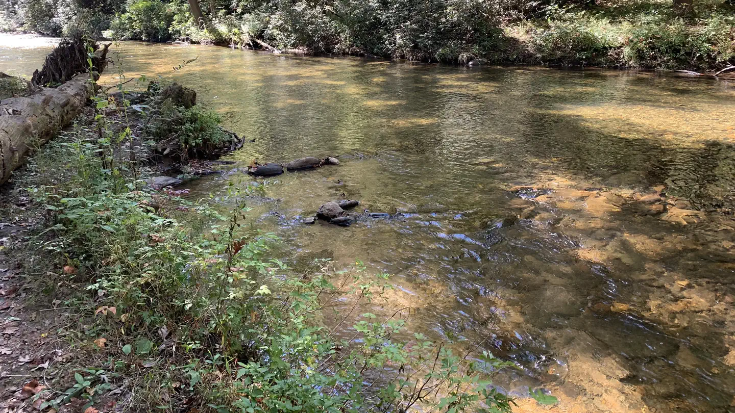
Site mix
| Standard, no hookups | 25 |
Site guide
Will my RV fit
The longest site here provides 10 feet of vehicle capacity. Most sites are shorter.
25 sites in 2 loops. Tap a filter to narrow the list; the map follows.
| Site | Loop | Entry | Fits, ft | Surface | Shade | People / vehicles | Fires | Accessible |
|---|---|---|---|---|---|---|---|---|
| Site 13 | Cooper Creek Loop | Back-in | 68 | Gravel | Partial | 5 / 2 | Yes | Yes |
| Site 14 | Cooper Creek Loop | Back-in | 45 | Gravel | Partial | 5 / 2 | Yes | Yes |
| Site 17 | Cooper Creek Loop | Back-in | 45 | Partial | 5 / 2 | Yes | Yes | |
| Site 18 | Cooper Creek Loop | Back-in | 45 | Gravel | Partial | 5 / 2 | Yes | Yes |
| Site 19 | Cooper Creek Loop | Back-in | 66 | Gravel | Partial | 5 / 2 | Yes | Yes |
| Site 20 | Cooper Creek Loop | Back-in | 50 | Gravel | Partial | 5 / 2 | Yes | Yes |
| Site 21 | Cooper Creek Loop | Back-in | 90 | Gravel | Partial | 5 / 2 | Yes | Yes |
| Site 22 | Cooper Creek Loop | Back-in | 99 | Gravel | Partial | 5 / 2 | Yes | Yes |
| Site 23 | Cooper Creek Loop | Pull-through | 10 | Partial | 5 / 2 | Yes | Yes | |
| Site 25 | Cooper Creek Loop | Back-in | 40 | Gravel | Partial | 5 / 2 | Yes | Yes |
Per-site records as published by the managing agency on Recreation.gov. Blank cells mean the agency listed nothing for that site. Check-in 03:00 PM, checkout 02:00 PM.
Amenities & rules
| Hookups | None |
| Equipment | RVs & trailers, Tents |
| Pets | Allowed |
| Campfires | Allowed, subject to restrictions |
| Accessibility | Sites Site 13, Site 14, Site 17, Site 18 and 21 more are listed accessible |
Cooper Creek Campgound has two vault toilets. One near site 23 at the Cooper Creek Loop and site 5 at Mulky. The campground has no flush toilets, showers, hook-ups, or dumstations. Drinking water is provided only during peak season, which is from April 1st though October 31st. Fees are reduced during off-peak when the water is shutoff and winterized. (November 1st through March 31st.
Individual sites vary. Confirm on Recreation.gov or with the managing office.
Season & status
| Status | Open |
| Season | Yearlong |
| Forest | Chattahoochee-Oconee National Forest |
| Booking | Reservations are required to camp in this campground. Reservations can be made through the National Recreation Reservation Service (NRRS). |
| Fees | Camping Peak Season: April 1 - October 31 $15 per night/site $30 Double Site (Site #24) Camping Non-Peak Season(no water): November 1 - March 31 $7.50 per night/site $15 Double Site (Site #24) |
| Rules | 14 day stay limit. Maximum 2 vehicles per campsite. Dogs must be leashed at all times. |
Weather by month
Getting there
From Blue Ridge, GA: take US 515 north for 4 miles to GA Hwy. 60; turn right and go 2 miles to Morganton, GA. In Morganton, turn right on GA Hwy. 60 south for 15.5 miles. Turn left on Forest Service Road 4, go 6 miles. From Blairsville, GA: GA take US 515 south 2.5 miles to Kiutuestia Creek Road. Turn left, go 1.3 miles.
| Nearest town | Suches, Georgia |
| Coordinates | 34.7612° N, 84.0746° W · Directions ↗ |
Supplies & services
| Outdoor gear | Mountain Crossings ↗ | 9.1 mi |
| RV sales & service | Blairsville RV Sales ↗ | 15.5 mi |
| Dump station | Dump station ↗ | 16.4 mi |
Locations © OpenStreetMap contributors. Call ahead; hours change seasonally.
Explore
Video
Cheap Campsites! Mulky Campground at Cooper Creek. North Georgia.
Worth a stop
If cooper creek is booked please check out Deep Hole Campground which is 15 minutes south. This campground has nine sites and is also a great place to catch fish along the Toccoa River. Deep Hole Recreation Area is about twenty minutes south of Blue Ridge, Georgia on GA Highway 60. If you turn down Rock Creek Road (FSR 69) you can find the Chattahoochee National Fish Hatchery, Frank Gross Recreation Area, and access to the Ed Jenkins National Recreation Area. Just a short drive down the highway are Woody Gap Recreation Area, Chestatee Overlook, or Dockery Lake Recreation Area. Nearby water falls to visit are Helton Creek Falls, Dukes Creeks Falls, Long Creek Falls, Fall Branch Falls, and Raven Cliffs Falls. Just a short drive and located within the Chattahoochee-Oconee National Forest, the Brasstown Bald Recreation Area & Visitor Center is a great place to visit. It is the highest point in Georgia, rising 4,784 feet above sea level with a 360 degree view of four states. Towns within a short drive to visit are Blairsville, Helen, Blue Ridge, and Dahlonega, GA.
- 4 miDeep Hole Day Use Pass ↗Day use
- 7.2 miWoody Gap Trailhead ↗Trailhead
- 9.8 miDesoto Falls Day Use Pass ↗Day use
- 11.3 miDavenport Ohv ↗OHV / range
- 11.5 miWhissenhunt Ohv ↗OHV / range
- 13.7 miLakewood Landing Boat Launch ↗Boat launch
Show all 7Hide
- 13.7 miLakewood Landing Boat Launch ↗Boat launch
Trails nearby
- 0.4 miYellow Mountain3.1 mi trail · hiking
- 0.4 miMill Shoals Trail ↗2.5 mi trail · hiking
- 0.5 miCooper Creek2.1 mi trail · hiking
- 1.7 miShope Gap0.6 mi trail · hiking
- 3.7 miDuncan Ridge ↗30 mi trail · hiking
- 3.7 miBenton Mackaye ↗22.3 mi trail · hiking, horse, bike
Trail and trailhead records are the Forest Service's. Distances are straight-line to the nearer trail end. Trail conditions are not tracked here.
Public land it sits in
This campground sits inside Chattahoochee-Oconee National Forests.
- inChattahoochee-Oconee National Forests ↗National Forest · Forest Service · 1,796,317 acres
- 5.4 miBlood Mountain Wilderness ↗Wilderness · Forest Service · 7,742 acres
- 11.1 miRaven Cliffs Wilderness ↗Wilderness · Forest Service · 9,240 acres
Each unit is published as a centre point and an acreage rather than a boundary, so this section stands it in for a circle of the same area. Whether a campground is inside, and how far it is from one it is outside, are both approximate.
Other campgrounds nearby



On the National Register nearby
- Blood Mountain Trail ShelterBuilding · Blairsville · 7.9 mi
- Walasi-Yi InnBuilding · Blairsville · 9.1 mi
- Old Union County CourthouseBuilding · Blairsville · 10.3 mi
Natural features
Cooper Creek Campground is settled inside The Cooper Creek Wildlife Management Area. It spans more than 30,000 acres, and lies within the Chattahoochee National Forest. This WMA offers hunting opportunities for deer, bear, turkey and small game. The trails in this wildlife management area offer nearly eight miles of easy to moderate hiking. The trails follow old logging trails and new footpaths through a variety of hardwood, mixed pine and hardwood, and white pine and hemlock forests.
Recreation
There are several hiking trails that start in or near the campground and all are interconnected, so forming a loop is a breeze. The Yellow Mountain Trail is the longest at 3.2 miles, so these are great little trails for taking the kids or the inexperienced hiker on. The Duncan Ridge Trail isn’t far up the road if you would like to do a more challenging hike. Yellow Mtn. Trail – 3.2 miles Connector Trail – 0.4 miles Mill Shoals Trail – 0.9 miles Shope Gap Trail – 0.6 miles Cooper Creek Trail – 1.7 miles
Guidebooks for Georgia
We earn a small commission if you buy through these links. It does not change what we list.
Titles come from Open Library's catalog, matched by subject heading or by title.
Reference
Questions people ask
Do I need a reservation at Cooper Creek Campground?
Sites at Cooper Creek Campground are reservable on Recreation.gov. Reservations are required to camp in this campground. Any walk-up sites are listed on the booking page.
Source: Recreation.gov
How much does it cost to camp at Cooper Creek Campground?
Camping Peak Season: April 1 - October 31 $15 per night/site $30 Double Site (Site #24) Camping Non-Peak Season(no water): November 1 - March 31 $7.50 per night/site $15 Double Site (Site #24)
Source: Recreation.gov
What time is check-in at Cooper Creek Campground?
Check-in 03:00 PM, checkout 02:00 PM.
Source: Recreation.gov
Is Cooper Creek Campground open right now?
Open as of Oct 16, 2026. Season Yearlong.
Source: Forest Service status
How many sites does Cooper Creek Campground have?
25 sites, including 25 standard sites without power.
Source: Recreation.gov
Can I bring an RV to Cooper Creek Campground?
Cooper Creek Campground is listed for tents only.
Source: Recreation.gov
Are there showers or a dump station at Cooper Creek Campground?
The campground has no flush toilets, showers, hook-ups, or dumstations.
Source: Recreation.gov
Are pets allowed at Cooper Creek Campground?
Yes, pets are allowed at Cooper Creek Campground. Leash rules apply.
Source: Recreation.gov
Can I have a campfire at Cooper Creek Campground?
Fires are allowed in the provided rings under normal conditions. 14 day stay limit.
Source: Recreation.gov
Are there accessible sites at Cooper Creek Campground?
Sites Site 13, Site 14, Site 17, and Site 18 are listed accessible on Recreation.gov, 25 sites in all. What that covers (a paved pad, an accessible table, a nearby accessible restroom) is on each site's booking page.
Source: Recreation.gov
What is there to do at Cooper Creek Campground?
There are several hiking trails that start in or near the campground and all are interconnected, so forming a loop is a breeze. The Recreation section on this page has the rest.
Source: Recreation
What is the nearest town to Cooper Creek Campground?
Suches, Georgia. If cooper creek is booked please check out Deep Hole Campground which is 15 minutes south.
Source: Getting there