Tyee Lookout
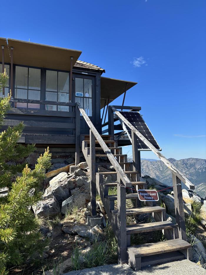
The Tyee Lookout sits at an elevation of 6,654 feet in the Okanogan-Wenatchee National Forest. Built in the 1950’s, the lookout was used by Forest Service personnel until the 1990’s. Starting with the access road, the lookout is accessible by four-wheel drive truck from mid-June to mid-October. The last 3.6 miles of the road are narrow, steep, sandy and very rocky; including two rock ledges, good tires are a must. Once at the lookout the ground is also rocky and uneven, just walking around can present challenges to those not fleet on their feet.
Check availability on Recreation.gov ↗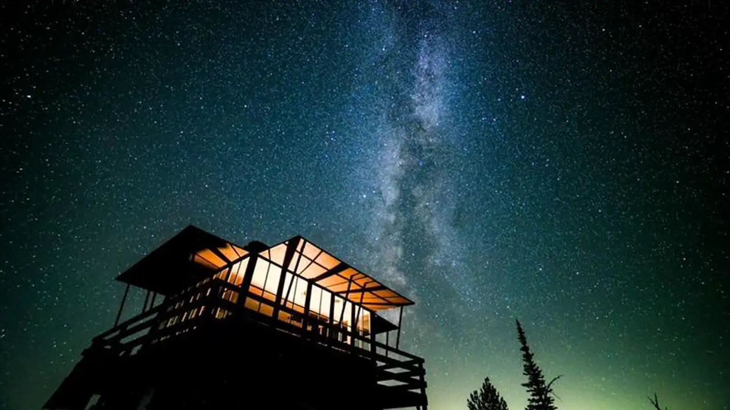

Site mix
| Fire lookouts | 1 |
Site guide
1 site. Tap a filter to narrow the list; the map follows.
| Site | Shade | Water / sewer | People / vehicles | Fires | Rating |
|---|---|---|---|---|---|
| Tyee Lookout | None | No / – | 4 / 2 | No | Prime |
Per-site records as published by the managing agency on Recreation.gov. Blank cells mean the agency listed nothing for that site. Check-in 03:00 PM, checkout 11:00 AM.
Amenities & rules
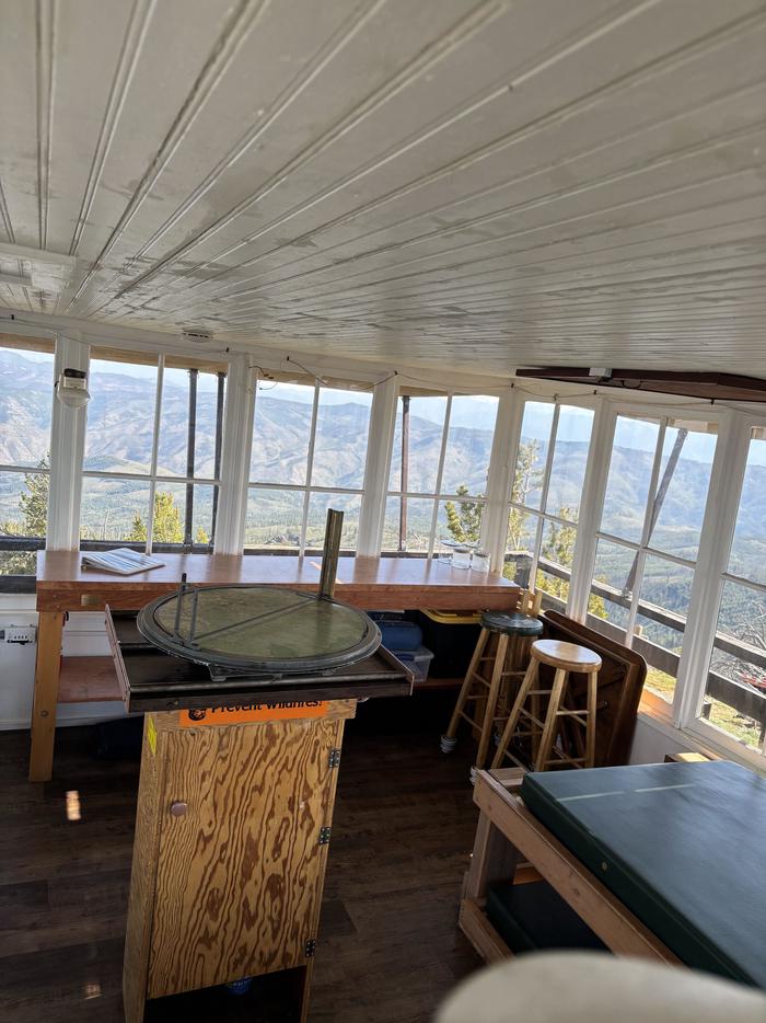
- The 16x16 cabin sleeps four and is equipped with four single foam mattresses, two on regular frames and two on trundle style frames. A bench, broom and dust pan are provided. A portable toilet is located 30 yards from the lookout behind a privacy screen. This is for poop not pee, please be prepared to pee away from the lookout behind a tree. The lookout has LED strip lights that provide a lot of l
- Guests must bring their own:
- Water for drinking, cooking and washing
- Cook stove and propane
- Cookware and dishes
- Bedding
- Flashlight, first aid supplies, trash bags and maybe a game or two.
Individual sites vary. Confirm on Recreation.gov or with the managing office.
Weather by month
Getting there
From the junction of Entiat River Road and 97A, driver 10.1 miles on the Entiat River Road. Turn left on county road 119A and cross the Entiat River. Drive 2.1 miles to the junction of FS road 5700 and FS road 5800, continue straight on FS road 5700. Road is now single lane paved road, parts of which are steep as it gains elevation to the ridge.
| Nearest town | Entiat, Washington |
| Coordinates | 47.8644° N, 120.4714° W · Directions ↗ |
Good to know
- A stay at Tyee is not for the faint of heart, this is a rough place.
Fire nearby
- WildfireLittle Giant
20 mi from the campground · 172,912 acres · 95% contained
- WildfireSisi
37 mi from the campground · 4,615 acres · 34% contained
- WildfireKing
46 mi from the campground · 3,427 acres · 36% contained
- WildfireThree Queens
48 mi from the campground · 9,575 acres · 33% contained
Distance is to the reported incident point, not the fire edge. Call the managing office before you drive.
Supplies & services
| Outdoor gear | Marine/Outdoor Supplies ↗ | 11.4 mi |
| Dump station | Trailer Dump Area ↗ | 12.1 mi |
| RV sales & service | Omar RV ↗ | 27 mi |
Locations © OpenStreetMap contributors. Call ahead; hours change seasonally.
Explore
Worth a stop
Billy Ridge and Tyee Ridge trails are adjacent to the lookout.
- 6.4 miNorth Tommy Trailhead ↗Trailhead
- 7.9 mi
Trails nearby
- 0.3 miBilly Ridge ↗5.5 mi trail
- 0.4 miTyee Ridge ↗8.5 mi trail
- 1.8 miBilly Creek ↗5.6 mi trail
- 3.2 miEntiat River Snowmobile ↗12.3 mi trail
- 4.2 miCougar Ridge ↗6.1 mi trail
- 4.6 miSouth Tommy ↗4.7 mi trail
Trail and trailhead records are the Forest Service's. Distances are straight-line to the nearer trail end. Trail conditions are not tracked here.
Public land it sits in
This campground sits inside Okanogan-Wenatchee National Forest.
- inOkanogan-Wenatchee National Forest ↗National Forest · Forest Service · 3,858,129 acres
- 10.4 miMt. Baker-Snoqualmie National Forest ↗National Forest · Forest Service · 2,025,595 acres
Each unit is published as a centre point and an acreage rather than a boundary, so this section stands it in for a circle of the same area. Whether a campground is inside, and how far it is from one it is outside, are both approximate.
Other campgrounds nearby

Cabin and lookout rentals nearby
On the National Register nearby
- Tyee Mountain LookoutBuilding · Entait · 0 mi
- Sugarloaf Peak LookoutBuilding · Leavenworth · 7.9 mi
- Steliko Ranger StationBuilding · Ardenvoir · 9.8 mi
Natural features
Views from the lookout include Stormy Mountain, numerous peaks in the Alpine Lakes Wilderness and east to the Waterville Plateau. The rocky outcrop is home to whitebark pine, a species on decline, please respect and admire this tree.
Recreation
Nearby roads, the Tyee Ridge trail and Billy Ridge trail offer opportunities for hiking, mountain biking, and dirt biking. Although you may still see the light of a faraway house from the top, the star gazing is still very good.
Guidebooks for Washington
We earn a small commission if you buy through these links. It does not change what we list.
Titles come from Open Library's catalog, matched by subject heading or by title.
Reference
Questions people ask
Do I need a reservation at Tyee Lookout?
Sites at Tyee Lookout are reservable on Recreation.gov. Any walk-up sites are listed on the booking page.
Source: Recreation.gov
What time is check-in at Tyee Lookout?
Check-in 03:00 PM, checkout 11:00 AM.
Source: Recreation.gov
How many sites does Tyee Lookout have?
1 site, including 1 lookout.
Source: Recreation.gov
Is there cell service at Tyee Lookout?
FCC coverage maps show T-Mobile 5G at the campground point. Terrain changes that from one site to the next.
Source: FCC Broadband Map
What is there to do at Tyee Lookout?
Nearby roads, the Tyee Ridge trail and Billy Ridge trail offer opportunities for hiking, mountain biking, and dirt biking. The Recreation section on this page has the rest.
Source: Recreation
What is the nearest town to Tyee Lookout?
Entiat, Washington. Billy Ridge and Tyee Ridge trails are adjacent to the lookout.
Source: Getting there
What if Tyee Lookout is full?
The nearest public campgrounds are Lake Creek Campground (5.3 mi, partly first-come), Silver Falls Group Site (7.3 mi, partly first-come), and Pine Flats Group Campground (7.6 mi, partly first-come).
Source: Campgrounds nearby