Prairie Point Campground
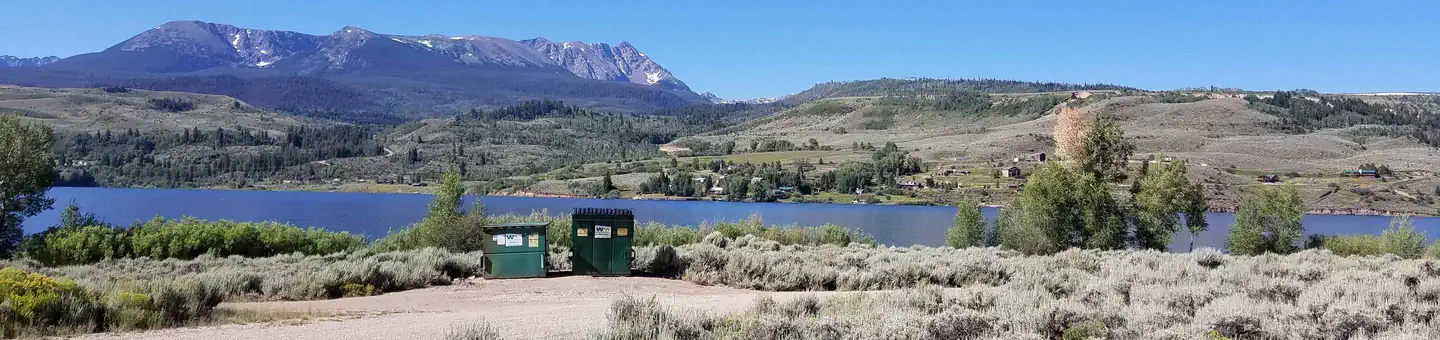
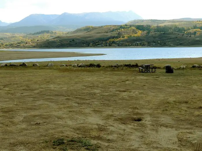
Prairie Point Campground is located north of Silverthorne, near the upper end of Green Mountain Reservoir along its east side. The reservoir is located 15 miles north of Silverthorne along Hwy 9 and has views of the Williams Fork and Gore mountain ranges.
More like this: reservable in Colorado · pets allowed in Colorado
Check availability on Recreation.gov ↗
Site mix
| Standard, no hookups | 22 |
Site guide
22 sites. Tap a filter to narrow the list; the map follows.
| Site | Entry | Fits, ft | People / vehicles | Fires |
|---|---|---|---|---|
| 001 | Back-in | 83 | 10 / 1 | Yes |
| 002 | Back-in | 62 | 10 / 1 | Yes |
| 003 | Back-in | 66 | 10 / 1 | Yes |
| 004 | Back-in | 57 | 10 / 1 | Yes |
| 005 | Back-in | 48 | 10 / 1 | Yes |
| 006 | Back-in | 49 | 10 / 1 | Yes |
| 007 | Back-in | 50 | 10 / 1 | Yes |
| 008 | Back-in | 35 | 10 / 1 | Yes |
| 009 | 52 | 10 / 1 | Yes | |
| 010 | 52 | 10 / 1 | Yes |
Per-site records as published by the managing agency on Recreation.gov. Blank cells mean the agency listed nothing for that site. Check-in 02:00 PM, checkout 11:00 AM.
Amenities & rules
| Hookups | None |
| Equipment | RVs & trailers, Tents |
| Pets | Allowed |
| Campfires | Allowed, subject to restrictions |
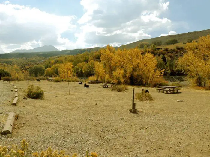
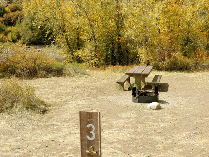
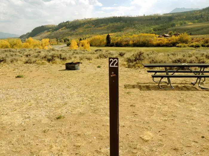
There are 2 loops with vault toilets. Each site has a picnic table and fire ring with most having parking spaces in front of the walk-in site. A few parking spaces are long enough to accommodate small trailers.
Individual sites vary. Confirm on Recreation.gov or with the managing office.
Season & status
| Forest | White River National Forest |
| Rules | Boat inspections are required to prevent the spread of Aquatic Nuisance Species (ANS). |
Weather by month
Getting there
From I-70 take Exit 205, Silverthorne/Dillon, and travel north on HWY 9 for 17 miles. The campground will be on your left along Green Mountain Reservoir.
| Nearest town | Silverthorne, Colorado |
| Coordinates | 39.8427° N, 106.2313° W · Directions ↗ |
Fire nearby
- WildfireWillow
44 mi from the campground · 7,359 acres · 92% contained
- PrescribedHarris Park Broadcast Rx
45 mi from the campground · 390 acres
Distance is to the reported incident point, not the fire edge. Call the managing office before you drive.
Supplies & services
| Outdoor gear | Marmot ↗ | 15.9 mi |
| Dump station | Dump station ↗ | 23.4 mi |
| RV sales & service | RV sales & service ↗ | 55.7 mi |
Locations © OpenStreetMap contributors. Call ahead; hours change seasonally.
Explore
Video
Prairie Point Campground - Green Mountain Reservoir
Worth a stop
- 11.6 miWilliams Fork Trailhead ↗Trailhead
- 11.6 miWilliams Fork Trailhead Day Use ↗Trailhead
- 14.6 miBarger Gulch Fishing Access ↗Fishing site
Trails nearby
- 0.1 miShane Gulch1.6 mi trail · hiking, horse, bike
- 2.6 miBrush Creek0.6 mi trail · hiking, horse
- 2.8 miLost Lake Trail3.6 mi trail · hiking, horse
- 3.1 miWilliams Peak ↗6.7 mi trail · hiking, horse, bike
- 3.6 miSouth Rim Black Creek3.7 mi trail · hiking, horse
- 4.2 miSurprise Trail2.4 mi trail · hiking, horse
Trailheads within three miles
- 2.6 miBrush Creek TH #68 ↗White River National Forest
- 2.6 miLost Lake #64 ↗White River National Forest
Trail and trailhead records are the Forest Service's. Distances are straight-line to the nearer trail end. Trail conditions are not tracked here.
Public land it sits in
Eagles Nest Wilderness begins about 1.9 miles away, and it is the closest of these.
- 1.9 miEagles Nest Wilderness ↗Wilderness · Forest Service · 135,104 acres
- 5.1 miWhite River National Forest ↗National Forest · Forest Service · 2,482,711 acres
- 11.3 miPtarmigan Peak Wilderness ↗Wilderness · Forest Service · 12,615 acres
Each unit is published as a centre point and an acreage rather than a boundary, so this section stands it in for a circle of the same area. Whether a campground is inside, and how far it is from one it is outside, are both approximate.
Other campgrounds nearby


Cabin and lookout rentals nearby
On the National Register nearby
- Slate Creek BridgeStructure · Slate Creek · 5.5 mi
- E. C. Yust HomesteadBuilding · Kremmling · 13.3 mi
Natural features
In the heart of the Rocky Mountains, the 2.3-million-acre White River National Forest is a place of serenity and adventure, boasting eight wilderness areas, four defined seasons and ten peaks surpassing 14,000 feet in elevation. The White River National Forest was established in 1891 as the White River Plateau Timber Reserve; the second such reserve to be named in the United States. In 1905, the newly formed Forest Service was given authority of the reserve. Long before this designation, the area was home to the Ute Indians who followed herds of elk and bison on their seasonal migrations. Wildlife in the area abounds. Bighorn sheep navigate rocky ridges and bull elk bugle at dusk. Scenic rivers sustain populations of cutthroat, rainbow and brown trout. Alpine regions provide habitat for pika and ptarmigan.
Recreation
In addition to boating, there are a variety of activities including camping, fishing, picnicking, jet skiing, water skiing, swimming and hiking.
Guidebooks for Colorado
We earn a small commission if you buy through these links. It does not change what we list.



Titles come from Open Library's catalog, matched by subject heading or by title.
Reference
Questions people ask
Do I need a reservation at Prairie Point Campground?
Sites at Prairie Point Campground are reservable on Recreation.gov. Any walk-up sites are listed on the booking page.
Source: Recreation.gov
What time is check-in at Prairie Point Campground?
Check-in 02:00 PM, checkout 11:00 AM.
Source: Recreation.gov
How many sites does Prairie Point Campground have?
22 sites, including 22 standard sites without power.
Source: Recreation.gov
Can I bring an RV to Prairie Point Campground?
Prairie Point Campground is listed for tents only.
Source: Recreation.gov
Are pets allowed at Prairie Point Campground?
Yes, pets are allowed at Prairie Point Campground. Leash rules apply.
Source: Recreation.gov
Can I have a campfire at Prairie Point Campground?
Fires are allowed in the provided rings under normal conditions. As of 2026-10-16, there are 2 active fires within 50 miles, so check current restrictions before you light one. Boat inspections are required to prevent the spread of Aquatic Nuisance Species (ANS).
Source: Fire nearby
What is the nearest town to Prairie Point Campground?
Silverthorne, Colorado.
Source: Getting there
What if Prairie Point Campground is full?
The nearest public campgrounds are McDonald Flats Campground (0.7 mi, first-come), Cow Creek South (3.5 mi), and Cataract Creek Campground (4 mi, first-come).
Source: Campgrounds nearby