Virgin River Canyon Recreation Area
The Virgin River Canyon Recreation Area is located along Interstate 15 approximately 20 miles southwest of St. George, Utah and approximately 20 miles northeast of Mesquite, Nevada. It's accessed from the Cedar Pocket Exit (mile post 18). The overnight-use fee is $8 per site per night and the day-use fee is $2 per vehicle. Overnight use is limited to 14-night stays.
More like this: reservable in Arizona · big rigs in Arizona · pets allowed in Arizona · group sites in Arizona
Check availability on Recreation.gov ↗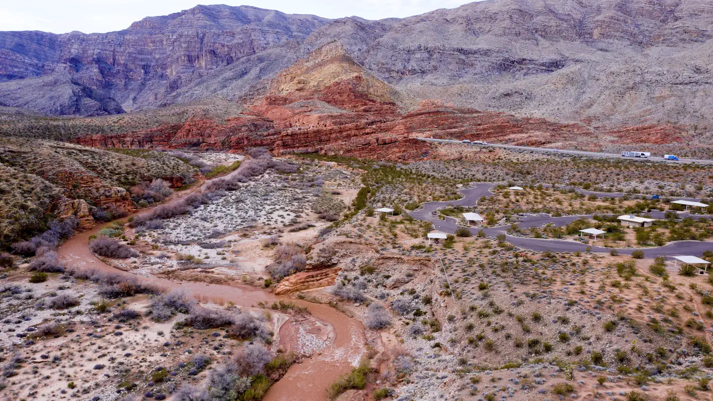
Site mix
| RV, no hookups | 50 |
| Tent-only | 29 |
| parking | 28 |
| group shelter nonelectric | 2 |
| Host/management | 2 |
Site guide
109 sites in 2 loops. Tap a filter to narrow the list; the map follows.
| Site | Loop | Type | Shade | People / vehicles | Fires | Accessible |
|---|---|---|---|---|---|---|
| 75 | Lower Loop | RV | – / 2 | Yes | ||
| 76 | Lower Loop | RV | – / 2 | Yes | ||
| 77 | Lower Loop | RV | – / 2 | Yes | ||
| 78 | Lower Loop | RV | – / 2 | Yes | ||
| 79 | Lower Loop | RV | – / 2 | Yes | ||
| 80 | Lower Loop | Parking | – / 2 | Yes | ||
| 81 | Lower Loop | Parking | – / 2 | Yes | ||
| 82 | Lower Loop | Parking | – / 2 | Yes | ||
| 83 | Lower Loop | Parking | – / 2 | Yes | ||
| 84 | Lower Loop | Parking | – / 2 | Yes |
Per-site records as published by the managing agency on Recreation.gov. Blank cells mean the agency listed nothing for that site. Check-in 04:00 PM, checkout 10:00 AM.
Amenities & rules
| Max vehicle length | 130 ft |
| Pets | Allowed |
| Campfires | Allowed, subject to restrictions |
| Fees | Overnight Use is $8/night (for up to two vehicles). Discount of 50% with Senior or Access America the Beautiful - The National Parks and Federal Recreational Lands Pass. Day Use is $2/vehicle. |
| Accessibility | Sites 93, 96, 97, 103 and 4 more are listed accessible |
- Campsite Amenities (108 overnight sites) - 14-night stay limit
- Paved access road
- Pull-through parking
- Drinking water
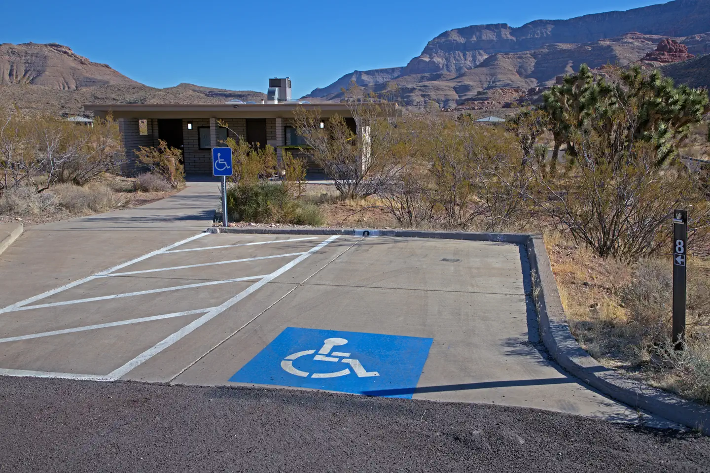
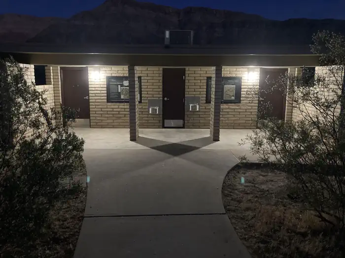
- Flush toilets (ADA compliant at middle restroom)
- Picnic table
- Grill and/or fire pit
- Vehicle or RV parking
- 8 sites that are ADA compliant
- 12 sites with shade shelters
- The campground has no electrical or waste dump hook ups.
- Day-Use Amenities - daylight hours only
- Paved access road
- Pull-through parking
- Drinking water
- Flush toilets
- Shade shelters
- ADA compliant sites
- Access to Sullivan Canyon Trail in the Paiute Wilderness
- Access to interpretative trail
Individual sites vary. Confirm on Recreation.gov or with the managing office.
Weather by month
Getting there
Virgin River Canyon Recreation Area is located along Interstate 15 approximately 20 miles southwest of St. George, Utah and approximately 20 miles northeast of Mesquite, Nevada. The recreation area is at the Cedar Pocket Exit (Mile Post 18).
| Nearest town | Littlefield, Arizona |
| Coordinates | 36.9511° N, 113.7935° W · Directions ↗ |
Good to know
- The recreation area currently has 25 of the best sites only available through recreation.gov reservations.
- The remaining 83 sites are first come, first serve payable onsite by using the Scan and Pay feature on the recreation.gov app.
- Please come prepared by either making a reservation here before arrival OR having the recreation.gov app installed with login setup to pay onsite with the scan and pay option.
Charges and cancellations
Cancellations*: *cancellation becomes a "late cancellation" at 12:01 am EST on the day before arrival. • $10.00 fee if reservation is changed/cancelled earlier than the day before arrival. • $10.00 plus first night's camping fee is charged if reservation is cancelled the day before or the day of the arrival, except when the reservation is only for 1 night (in which case only the first night's camping fee is charged).
Supplies & services
| Outdoor gear | Camping World ↗ | 14.6 mi |
| Dump station | Dump station ↗ | 17.7 mi |
| RV sales & service | Gander RV ↗ | 30.8 mi |
Locations © OpenStreetMap contributors. Call ahead; hours change seasonally.
Explore
Video
Virgin River Canyon Recreation Area Best Campsites - Arizona
Public land it sits in
This campground sits inside Beaver Dam Mountains Wilderness.
- inBeaver Dam Mountains Wilderness ↗Wilderness · Bureau of Land Management · 18,667 acres
- 3.4 miPaiute Wilderness ↗Wilderness · Bureau of Land Management · 87,900 acres
- 9.1 miBeaver Dam Wash National Monument ↗National Monument · Bureau of Land Management · 20,429 acres
Each unit is published as a centre point and an acreage rather than a boundary, so this section stands it in for a circle of the same area. Whether a campground is inside, and how far it is from one it is outside, are both approximate.
Other campgrounds nearby

On the National Register nearby
- Wallace Blake HouseBuilding · St. George · 12.3 mi
- Sand Hollow Wash BridgeStructure · Littlefield · 14.3 mi
- Jacob Hamblin HouseBuilding · Santa Clara · 14.6 mi
Natural features
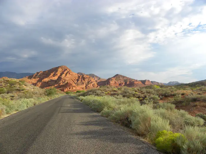
The Virgin River Gorge, where the Virgin River Canyon Recreation Area resides, was cut by the Virgin River. Though the Virgin River is relatively small, it is incredibly steep, dropping an average of 70 feet per mile - 10 times steeper than the Colorado River through the Grand Canyon. This steepness, caused by the uplift of the Colorado Plateau, has given the Virgin River the ability to cut through sandstone and limestone canyons. The gorge provides a stunning and colorful mountain desert setting. The gorge mimics, on a smaller scale, the colorful layers and striking depths of the Grand Canyon. In fact, many of the very same geologic formations are present in both areas. The gorge connects the southwestern rim of the Colorado Plateau and the northeastern part of the Mojave Desert. The climate of the gorge is typical of the Mojave Desert with hot summers and mild winters. This desert climate allows for some of the most northern Joshua Tree populations. The canyon is usually about 5 degrees Fahrenheit warmer than St George, Utah, however the canyon can occasionally amplify winds. Many species depend on the water of the Virgin River.
Recreation
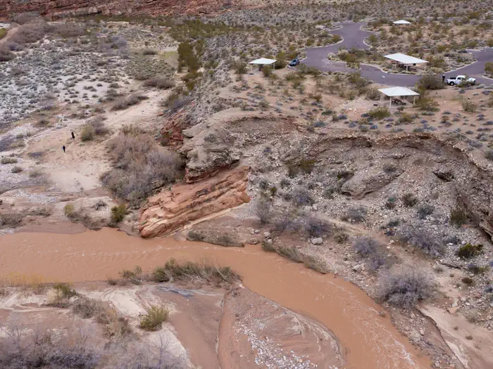
The Virgin River Canyon Recreation Area provides many recreational opportunities for hiking, wildlife viewing, water play, and more. It is surrounded by two designated wilderness areas. The Paiute Wilderness east of Interstate 15, and Beaver Dam Mountains Wilderness to the west. The Sullivan Canyon Trail starts within the recreation area and heads into the heart of the Paiute Wilderness. The campground and day-use areas also both have scenic trails leading to the Virgin River. The Virgin River is occasionally runnable to small whitewater boats during spring runoffs. Please check for information on the fish barriers and flow conditions prior to running. Additional hiking opportunities are available. A short drive on the Cedar Pocket Road (directly across the interstate from the campground) leads to the Cedar Pocket Wash Trailhead. This trail leads down a steep path to the narrows of the Cedar Pocket Wash and is a nice short stroll through a Joshua Tree forest. Several other trails can be accessed along this road or from hiking trails within the recreation area. A trails map is viewable on the site's restroom kiosks or can be downloaded as a PDF map or to the Avenza app.
Nearby
- Hiking Trails
- The most popular hike is a simple 0.1 mile hike down to the Virgin River via the River Trail. This is easily accessed from the lowest parking in the lower loop.
- The easiest trail is the 0.4 mile Canyon Overlook Trail. This trail begins at the fee kiosk. It is a paved, ADA trail leading to an overlook and interpretative compass display.
- The best hike is the Narrows hike. This is a steep, 1.4 mile hike leading through a Joshua Tree grove down to a limestone narrows punching through a geologic fold. The best starting point is a short drive up to the Cedar Pocket Wash Trailhead.
- A full of views hike is the Ridgeline Loop. This is a 1.1 mile loop starting at the I-15 trailhead. The trail follows the ridgeline up about 1000 ft above the start and loops back.
- For the more adventurous, Greyhaven Pinnacle is a exposed scramble up a limestone peak with wondrous views from the middle of the Virgin River Gorge. This 1.8 mile trail is accessed from I-15 Trailhead.
Guidebooks for Arizona
We earn a small commission if you buy through these links. It does not change what we list.
- Best Backpacking Trips in Utah, Arizona, and New MexicoMike White and Douglas Lorain, 2016Find at Bookshop.org
Titles come from Open Library's catalog, matched by subject heading or by title.
Reference
Questions people ask
Do I need a reservation at Virgin River Canyon Recreation Area?
Sites at Virgin River Canyon Recreation Area are reservable on Recreation.gov. Any walk-up sites are listed on the booking page.
Source: Recreation.gov
How much does it cost to camp at Virgin River Canyon Recreation Area?
Overnight Use is $8/night (for up to two vehicles). Discount of 50% with Senior or Access America the Beautiful - The National Parks and Federal Recreational Lands Pass. Day Use is $2/vehicle.
Source: Recreation.gov
What time is check-in at Virgin River Canyon Recreation Area?
Check-in 04:00 PM, checkout 10:00 AM.
Source: Recreation.gov
What does it cost to cancel a reservation at Virgin River Canyon Recreation Area?
• $10.00 fee if reservation is changed/cancelled earlier than the day before arrival.
Source: Charges and cancellations
How many sites does Virgin River Canyon Recreation Area have?
111 sites, including 50 RV sites without hookups, 29 tent-only sites, 28 parking, and 2 group shelter nonelectric.
Source: Recreation.gov
Will my RV fit at Virgin River Canyon Recreation Area?
Recreation.gov lists no practical vehicle capacity limit for the largest site here, which usually means pull-through or open parking. The sidebar tool checks a trailer or motorhome length against every site.
Source: Will my RV fit
Are there showers or a dump station at Virgin River Canyon Recreation Area?
Flush toilets (ADA compliant at middle restroom)
Source: Recreation.gov
Are pets allowed at Virgin River Canyon Recreation Area?
Yes, pets are allowed at Virgin River Canyon Recreation Area. Leash rules apply.
Source: Recreation.gov
Can I have a campfire at Virgin River Canyon Recreation Area?
Fires are allowed in the provided rings under normal conditions.
Source: Recreation.gov
Are there accessible sites at Virgin River Canyon Recreation Area?
Sites 93, 96, 97, and 103 are listed accessible on Recreation.gov, 8 sites in all. What that covers (a paved pad, an accessible table, a nearby accessible restroom) is on each site's booking page.
Source: Recreation.gov
What is there to do at Virgin River Canyon Recreation Area?
The Virgin River Canyon Recreation Area provides many recreational opportunities for hiking, wildlife viewing, water play, and more. The Recreation section on this page has the rest.
Source: Recreation
What is the nearest town to Virgin River Canyon Recreation Area?
Littlefield, Arizona. Hiking Trails
Source: Getting there