Valley Of Fires Recreation Area
Valley of Fires recreation area is located immediately adjacent to the Malpais Lava Flow. Approximately 5,000 years ago, Little Black Peak erupted and flowed 44 miles into the Tularosa Basin, filling the basin with molten rock. The resulting lava flow is four to six miles wide, 160 feet thick and covers 125 square miles. The lava flow is considered to be one of the youngest lava flows in the continental United States. The Bureau of Land Management maintains and manages the Valley of Fires Recreation area, which is located four miles west of Carrizozo, NM, on US Highway 380. Valley of Fires offers both camping and day use.
More like this: electric hookups in New Mexico · reservable in New Mexico · big rigs in New Mexico · pets allowed in New Mexico · group sites in New Mexico
Check availability on Recreation.gov ↗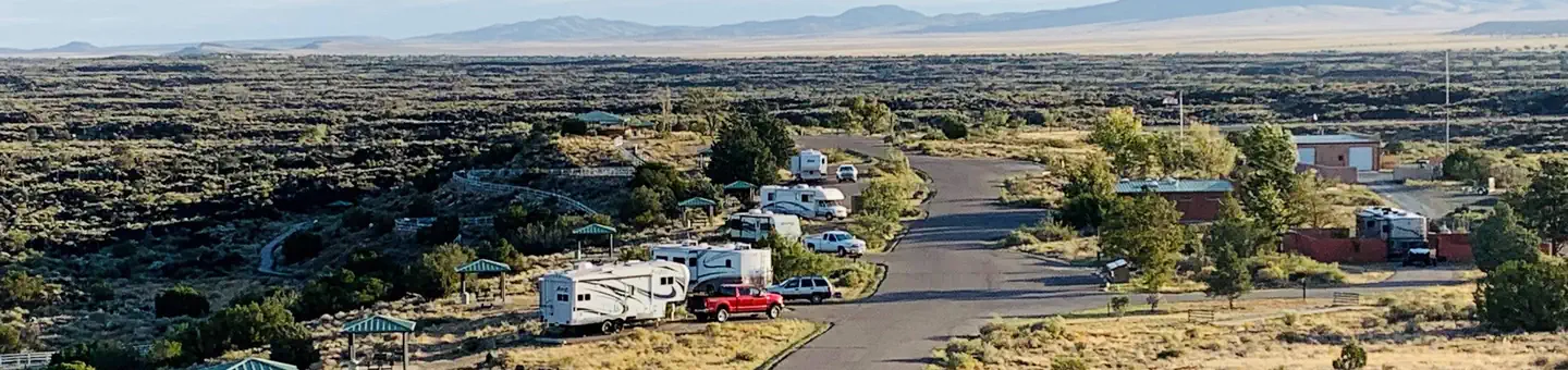
Site mix
| RV with electric | 13 |
| Tent-only | 7 |
| RV, no hookups | 6 |
| group shelter electric | 1 |
Site guide
Will my RV fit
The longest site here provides 40 feet of vehicle capacity. Most sites are shorter.
27 sites. Tap a filter to narrow the list; the map follows.
| Site | Type | Entry | Fits, ft | Surface | Shade | Power | Water / sewer | Fires | Accessible |
|---|---|---|---|---|---|---|---|---|---|
| Site 1 | RV | Pull-through | 20 | Paved | No | Yes | |||
| Site 2 | RV electric | Pull-through | 40 | Paved | Partial | 50 amp | Yes / – | Yes | |
| Site 3 | RV electric | Pull-through | 40 | Paved | Partial | 50 amp | Yes / – | Yes | |
| Site 4 | RV electric | Back-in | 40 | Paved | Partial | 50 amp | Yes / – | Yes | Yes |
| Site 5 | RV electric | Pull-through | 40 | Paved | Partial | 50 amp | Yes / – | Yes | |
| Site 6 | RV electric | Pull-through | 40 | Paved | Partial | 50 amp | Yes / – | Yes | |
| Site 7 | RV electric | Pull-through | 40 | Paved | Partial | 50 amp | Yes / – | Yes | |
| Site 8 | RV electric | Back-in | 40 | Paved | Partial | 50 amp | Yes / – | Yes | |
| Site 9 | RV electric | Back-in | 40 | Paved | Partial | 50 amp | Yes / – | Yes | |
| Site 10 | RV electric | Back-in | 40 | Paved | Partial | 50 amp | Yes / – | Yes |
Per-site records as published by the managing agency on Recreation.gov. Blank cells mean the agency listed nothing for that site. Check-in 11:00 AM, checkout 02:00 PM.
Amenities & rules
| Hookups | Electric, water |
| Max vehicle length | 40 ft |
| Equipment | RVs & trailers, Tents |
| Pets | Allowed |
| Campfires | Allowed, subject to restrictions |
| Accessibility | Sites Site 4, Site 12, Group Shelter 1, Group Shelter 2 are listed accessible |
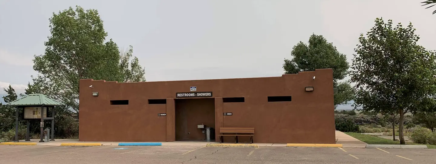
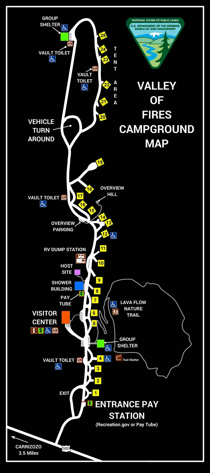
Each camp site features picnic shelter and picnic tables, tent pads (tent camping area), pedestal grills, campfire rings (most sites) as well as a trash can. There is a shower house with flush toilets centrally located within the campground, as well as accessible vault toilets and water spigots scattered throughout the area. Showers are included in your camping fee, or can be used by non-campers for a fee of $6. The on-site dump station charge is included in camping fees or it can be utilized by non-campers for a $30 fee. Dump Station open from 7 AM to 7PM. To dump at other times please make arrangements with Camp Host. One dump allowed per visit. Additional dumps will be charged $30/dump. Please be able to provide proof of payment to Camp Host or other BLM staff to be permitted to utilize dump station. The bookstore and gift shop offers information on the recreation area, wildlife and other nearby activities as well as offering the opportunity to purchase a wide variety of stuffed animals, books and other recreation area keepsakes.
Individual sites vary. Confirm on Recreation.gov or with the managing office.
Weather by month
Getting there
Travel four miles west of the town of Carrizozo on U.S. Highway 380. Valley of Fires recreation area is on the left.
| Nearest town | Carrizozo, New Mexico |
| Coordinates | 33.6848° N, 105.9200° W · Directions ↗ |
Good to know
- Some of the campsites offer online reservations through Recreation.gov - Camping, Cabins, RVs, Permits, Passes & More.
Fire nearby
- PrescribedD1 Programmatic Piles Rx
29 mi from the campground
Distance is to the reported incident point, not the fire edge. Call the managing office before you drive.
Supplies & services
| Dump station | RV Dump Station ↗ | 0.3 mi |
Locations © OpenStreetMap contributors. Call ahead; hours change seasonally.
Explore
Video
Camping at Valley of Fires National Rec Area
Public land it sits in
White Mountain Wilderness begins about 11.3 miles away, and it is the closest of these.
- 11.3 miWhite Mountain Wilderness ↗Wilderness · Forest Service · 46,963 acres
Each unit is published as a centre point and an acreage rather than a boundary, so this section stands it in for a circle of the same area. Whether a campground is inside, and how far it is from one it is outside, are both approximate.
Other campgrounds nearby



Cabin and lookout rentals nearby
On the National Register nearby
- Carrizozo Woman's ClubBuilding · Carrizozo · 3.7 mi
- Paden's Drug StoreBuilding · Carrizozo · 3.7 mi
Natural features
From a distance, Valley of Fires appears as barren rock but when you walk through the nature trail there are many varieties of flowers, cactus, trees and bushes typical of the Chihuahuan desert. Animals include bats, roadrunners, quail, cottontails, mule deer, barbary sheep, and lizards. It's also a virtual birdwatcher's paradise with great horned owls, burrowing owls, turkey vultures, hawks, gnat catchers, cactus wrens, sparrows and golden eagles.
Recreation
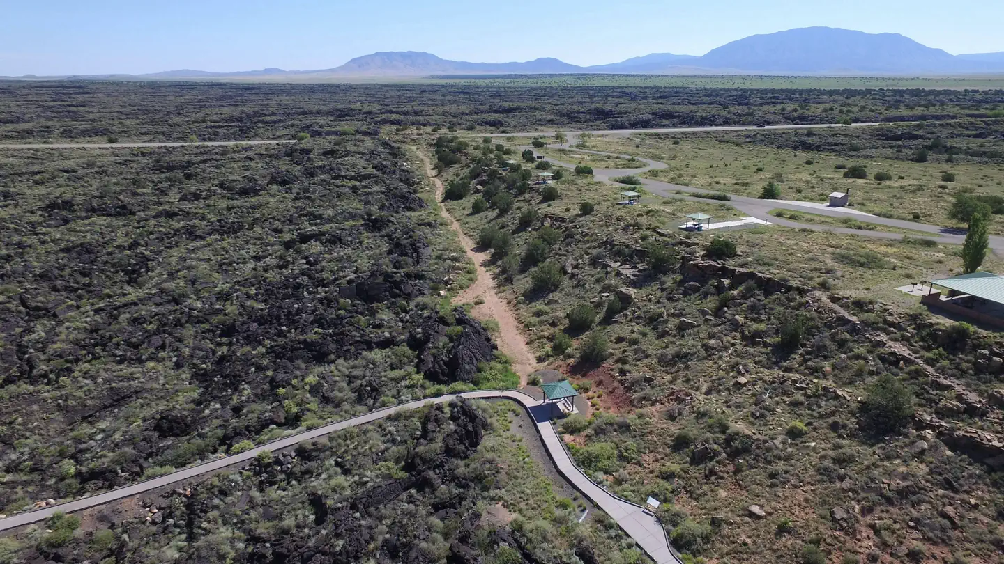
Camping: Valley of Fires Recreation area offers opportunities for RV Camping (both full-service and primitive camp sites), tent camping and day use. Each campsite and group shelter is equipped with picnic shelter and picnic table(s) for the public's enjoyment. Malpais Nature Trail: The Malpais Nature trail offers a unique experience of getting trail users out into the lava. The trail is paved and accessible. Wildlife is commonly seen on or from the trail during the warm months, especially in the early morning and late evening hours. These new signs provide updated information, including photos and artwork, about the lava flow, its inhabitants, and the surrounding area. Kipuka Trail: The Kipuka Trail is the latest addition to the Valley of Fires Recreation Area. This gentle dirt path meanders through the interior of the "Kipuka," an island of soil and vegetation encircled by the lava flow.
Nearby
Carrizozo Land Partnership The Carrizozo Land Partnership vehicle pass page is temporarily unavailable and the Roswell Field Office is currently unable to issue vehicle passes to cross private lands while collection policies for personal identifiable information are updated. The CLP, a partnership between the BLM, private landowners and ranchers of this area, has arranged for public access to BLM lands in this area by a vehicle pass process. Once on the BLM lands in the area, the public is allowed to hunt, camp, hike, observe wildlife and other appropriate recreational activities. This partnership provides access to many miles of roads and thousands of acres of public lands for recreational enjoyment. Terrain is from flat to rolling, with some bluffy/hilly country overlooking the lava flows.
Guidebooks for New Mexico
We earn a small commission if you buy through these links. It does not change what we list.
Titles come from Open Library's catalog, matched by subject heading or by title.
Reference
Questions people ask
Do I need a reservation at Valley Of Fires Recreation Area?
Sites at Valley Of Fires Recreation Area are reservable on Recreation.gov. Any walk-up sites are listed on the booking page.
Source: Recreation.gov
What time is check-in at Valley Of Fires Recreation Area?
Check-in 11:00 AM, checkout 02:00 PM.
Source: Recreation.gov
How many sites does Valley Of Fires Recreation Area have?
27 sites, including 13 RV sites with electric, 7 tent-only sites, 6 RV sites without hookups, and 1 group shelter electric.
Source: Recreation.gov
Will my RV fit at Valley Of Fires Recreation Area?
The longest site here provides 40 feet of vehicle capacity. Most sites are shorter. The sidebar tool checks a trailer or motorhome length against every site.
Source: Will my RV fit
Does Valley Of Fires Recreation Area have hookups?
Yes, electric and water hookups at some sites.
Source: Recreation.gov
Are there showers or a dump station at Valley Of Fires Recreation Area?
There is a shower house with flush toilets centrally located within the campground, as well as accessible vault toilets and water spigots scattered throughout the area.
Source: Recreation.gov
Are pets allowed at Valley Of Fires Recreation Area?
Yes, pets are allowed at Valley Of Fires Recreation Area. Leash rules apply.
Source: Recreation.gov
Can I have a campfire at Valley Of Fires Recreation Area?
Fires are allowed in the provided rings under normal conditions. As of 2026-10-16, there is 1 active fire within 50 miles, so check current restrictions before you light one.
Source: Fire nearby
Are there accessible sites at Valley Of Fires Recreation Area?
Sites Site 4, Site 12, Group Shelter 1, and Group Shelter 2 are listed accessible on Recreation.gov. What that covers (a paved pad, an accessible table, a nearby accessible restroom) is on each site's booking page.
Source: Recreation.gov
Is there cell service at Valley Of Fires Recreation Area?
FCC coverage maps show Verizon 4G LTE, AT&T 4G LTE, and T-Mobile 4G LTE at the campground point. Terrain changes that from one site to the next.
Source: FCC Broadband Map
What is there to do at Valley Of Fires Recreation Area?
Camping: Valley of Fires Recreation area offers opportunities for RV Camping (both full-service and primitive camp sites), tent camping and day use. The Recreation section on this page has the rest.
Source: Recreation
What is the nearest town to Valley Of Fires Recreation Area?
Carrizozo, New Mexico. Carrizozo Land Partnership The Carrizozo Land Partnership vehicle pass page is temporarily unavailable and the Roswell Field Office is currently unable to issue vehicle passes to cross private lands while collection policies for personal identifiable information are updated.
Source: Getting there