Self Creek
Self Creek and Jim Wylie Campgrounds are located just off of US hwy 70 on beautiful Lake Greeson. Access to the nearest boat ramp for these areas is located at the Self Creek Boat Ramp.
More like this: electric hookups in Arkansas · reservable in Arkansas · big rigs in Arkansas · pets allowed in Arkansas
Check availability on Recreation.gov ↗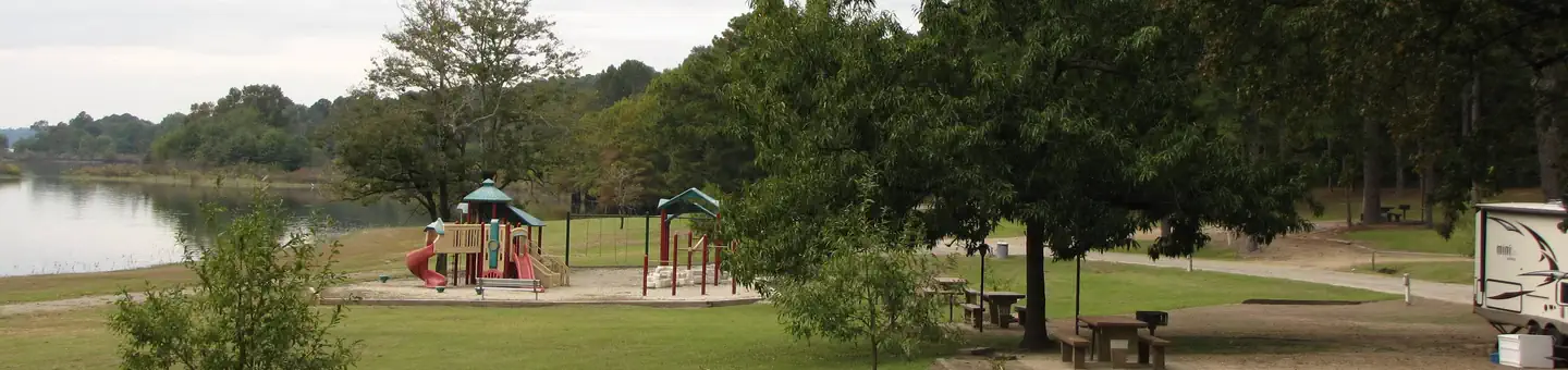

Site mix
| Standard with electric | 41 |
| Standard, no hookups | 31 |
Site guide
Will my RV fit
The longest site here provides 50 feet of vehicle capacity. Most sites are shorter.
72 sites in 2 loops. Tap a filter to narrow the list; the map follows.
| Site | Loop | Type | Entry | Fits, ft | Surface | Shade | Power | Waterfront | People / vehicles | Fires | Rating |
|---|---|---|---|---|---|---|---|---|---|---|---|
| 47 | JW | Electric | Back-in | 40 | Gravel | Partial | 30 amp | 10 / – | Yes | Basic | |
| 48 | JW | Electric | Pull-through | 40 | Paved | Partial | 30 amp | 10 / – | Yes | Basic | |
| 49 | JW | Electric | Pull-through | 33 | Paved | Partial | 30 amp | 10 / – | Yes | Basic | |
| 50 | JW | Electric | Pull-through | 35 | Paved | Partial | 30 amp | 10 / – | Yes | Basic | |
| 51 | JW | Electric | Pull-through | 32 | Paved | Partial | 30 amp | 10 / – | Yes | Basic | |
| 52 | JW | Electric | Pull-through | 37 | Paved | Partial | 30 amp | 10 / – | Yes | Basic | |
| 53 | JW | Electric | Pull-through | 38 | Paved | Partial | 30 amp | 10 / – | Yes | Basic | |
| 54 | JW | Electric | Pull-through | 35 | Paved | Partial | 30 amp | 10 / – | Yes | Basic | |
| 55 | JW | Electric | Pull-through | 36 | Paved | Partial | 30 amp | 10 / – | Yes | Basic | |
| 56 | JW | Electric | Pull-through | 36 | Paved | Partial | 30 amp | 10 / – | Yes | Basic |
Per-site records as published by the managing agency on Recreation.gov. Blank cells mean the agency listed nothing for that site. Check-in 06:00 PM, checkout 04:00 PM.
Amenities & rules
| Hookups | Electric, water |
| Max vehicle length | 50 ft |
| Equipment | RVs & trailers, Tents |
| Pets | Allowed |
| Campfires | Allowed, subject to restrictions |
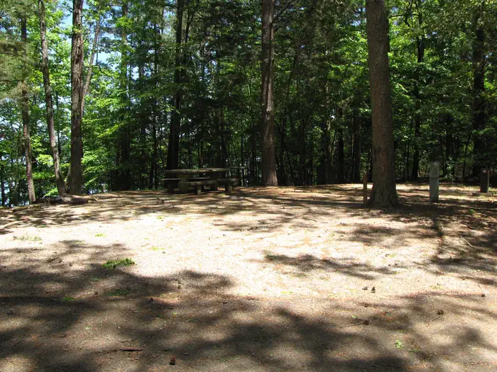
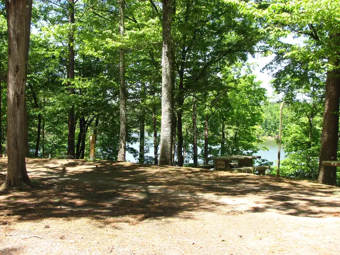
Self Creek area (sites 1 - 46) has 15 electrical sites. Sites 1-6 and 12-20 have 20 amp and 30 amp service. Each site provides a picnic table, ground grill, pedestal grill, and lantern post. Other amenities include flush toilets, showers, drinking water, swim beach, and playground. Dump station is located in the Jim Wylie area. Jim Wylie area (sites 47 - 72) all sites have 20 amp and 30 amp service. Site 47 has sewer and water hookup. Each site provides a picnic table, ground grill, pedestal grill, and lantern post. Other amenities include flush toilets, showers, drinking water, and dump station.
Individual sites vary. Confirm on Recreation.gov or with the managing office.
Weather by month
Getting there
From Hot Springs, AR take HWY 70 West. At the intersection of HWY 27 South and HWY 8 East turn left on to HWY 70 West. Continue west on HWY 70 until turning left into the campground.
| Nearest town | Kirby, Arkansas |
| Area | Recreation.gov lists no exact point for this campground. The recreation area is at 34.15° N, 93.72° W. Call the office before you drive. |
Explore
Video
Video of COE Lake Greeson Self Creek Jim Wylie Recreation Area and Campground, AR from Che
Natural features
Lake Greeson is about 12 miles long with over 7,260 surface acres of water fed by the clear cool waters of the Little Missouri River. Loblolly pine, shortleaf pine, sweet gum and oak are the dominate tree species on upland areas of the lake, while bottomland hardwoods are common along rivers, creeks and streams that enter the lake. The public lands around Lake Greeson provide a variety of habitats for numerous species of wildlife, including white-tailed deer, wild turkey, geese, bald eagles, migratory waterfowl, and songbirds.
Recreation
Lake Greeson is recognized for its rich variety of game fish, including large mouth, small mouth, stripped, spotted, and white bass, as well as flathead and channel catfish, black and white crappie, walleye, and blue gill. The clear waters offer an excelent opportunity for many boating activites including water skiing, tubing, personal water craft, or just cruising. Four marinas at the lake offer boaters' fuel, boat and other water craft rentals, picnic and fishing supplies.
Nearby
The Bear Creek Cycle Trail is a draw for off-road enthusiasts. Trail Access Points are located in nearby campground at Daisy State Park, Kirby Landing Campground, and Bear Creek Campground. Crater of Diamonds State Park is within a 40 mile drive of the campground. It is the only diamond-producing site in the world open to the public
Guidebooks for Arkansas
We earn a small commission if you buy through these links. It does not change what we list.
Titles come from Open Library's catalog, matched by subject heading or by title.
Reference
Questions people ask
Do I need a reservation at Self Creek?
Sites at Self Creek are reservable on Recreation.gov. Any walk-up sites are listed on the booking page.
Source: Recreation.gov
What time is check-in at Self Creek?
Check-in 06:00 PM, checkout 04:00 PM.
Source: Recreation.gov
How many sites does Self Creek have?
72 sites, including 41 standard sites with power and 31 standard sites without power.
Source: Recreation.gov
Will my RV fit at Self Creek?
The longest site here provides 50 feet of vehicle capacity. Most sites are shorter. The sidebar tool checks a trailer or motorhome length against every site.
Source: Will my RV fit
Does Self Creek have hookups?
Yes, electric and water hookups at some sites.
Source: Recreation.gov
Are there showers or a dump station at Self Creek?
Other amenities include flush toilets, showers, drinking water, swim beach, and playground.
Source: Recreation.gov
Are pets allowed at Self Creek?
Yes, pets are allowed at Self Creek. Leash rules apply.
Source: Recreation.gov
Can I have a campfire at Self Creek?
Fires are allowed in the provided rings under normal conditions.
Source: Recreation.gov
What is there to do at Self Creek?
Lake Greeson is recognized for its rich variety of game fish, including large mouth, small mouth, stripped, spotted, and white bass, as well as flathead and channel catfish, black and white crappie, walleye, and blue gill. The Recreation section on this page has the rest.
Source: Recreation
What is the nearest town to Self Creek?
Kirby, Arkansas. The Bear Creek Cycle Trail is a draw for off-road enthusiasts.
Source: Getting there