Maple Lake Campground
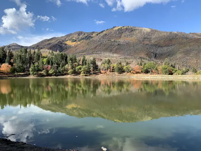
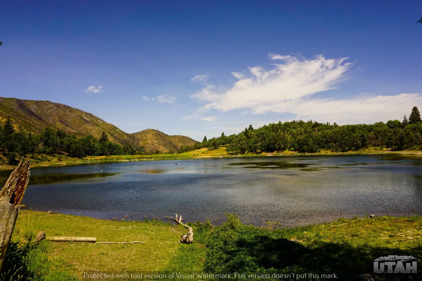
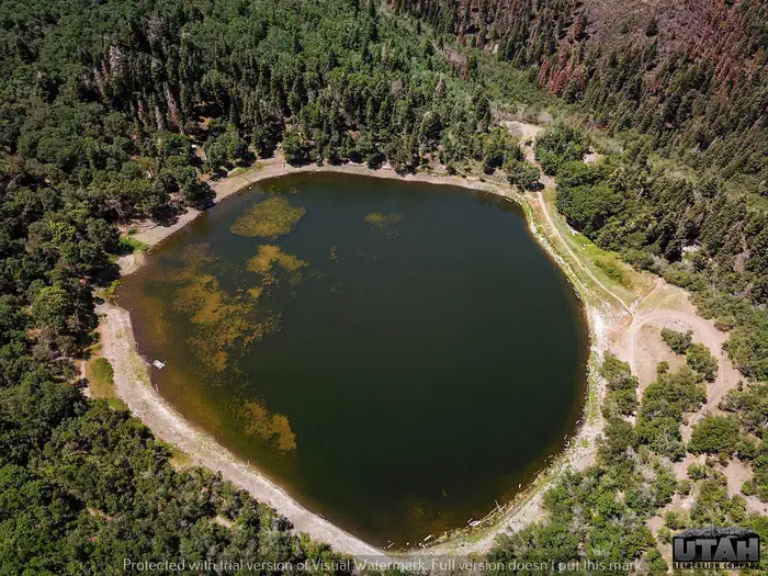
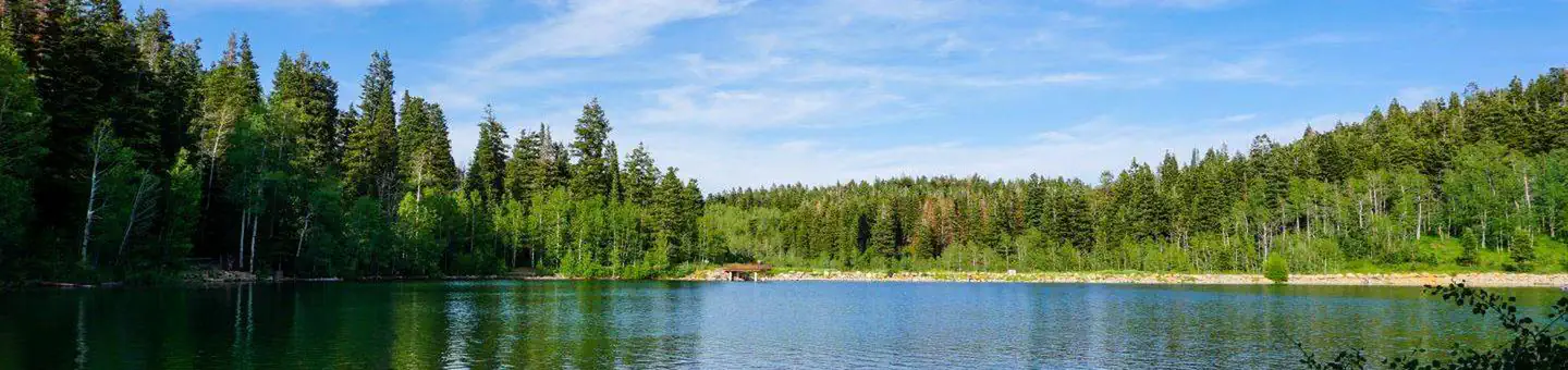
Maple Lake is a timbered setting with limited accessibility. Lake fishing and floating, rafting, kayaking, swimming and hiking are popular recreation activities for this area. Tents and very small campers work best at this campground. The elevation is 5,800 feet.
More like this: reservable in Utah · tent only in Utah · pets allowed in Utah
Check availability on Recreation.gov ↗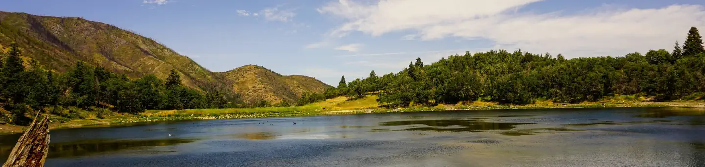
Site mix
| Standard, no hookups | 10 |
| Host/management | 1 |
Site guide
10 sites. Tap a filter to narrow the list; the map follows.
| Site | Entry | Water / sewer | People / vehicles | Fires |
|---|---|---|---|---|
| 1 | Back-in | No / – | 8 / 1 | Yes |
| 2 | Back-in | No / – | 8 / 1 | Yes |
| 3 | Back-in | No / – | 8 / 1 | Yes |
| 4 | Back-in | No / – | 8 / 1 | Yes |
| 5 | Back-in | No / – | 8 / 1 | Yes |
| 6 | Back-in | No / – | 8 / 1 | Yes |
| 7 | Back-in | No / – | 8 / 1 | Yes |
| 8 | Back-in | No / – | 8 / 1 | Yes |
| 9 | Back-in | No / – | 8 / 1 | Yes |
| 10 | Back-in | No / – | 8 / 1 | Yes |
Per-site records as published by the managing agency on Recreation.gov. Blank cells mean the agency listed nothing for that site. Check-in 03:00 PM, checkout 12:00 PM.
12 campsite locations mapped by OpenStreetMap contributors. The site numbers are theirs and may not match the posts at the campground. Map data © OpenStreetMap contributors, ODbL.
Amenities & rules
| Equipment | Tents |
| Pets | Allowed |
| Campfires | Allowed, subject to restrictions |
| Fees | Cash, Check, or Scan & Pay (with recreation.gov app). 10 single sites- $29.00, capacity 8 people + 1 vehicle. Day Use in a campground site - $15.00. Extra vehicle - $10.00 per vehicle (paid on-site cash/check). Firewood - $9.00 (located at Maple Bench Campground) |
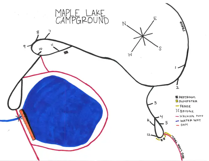
The campground has 10 single campsites available each with picnic and serving tables and campfire rings with grills. Vault restroom facilities are available. There is no water available at this campground.
Individual sites vary. Confirm on Recreation.gov or with the managing office.
Season & status
| Status | Closed for the season. Forest Service sites close for the season; check the official page for the reopening date. |
| Forest | Uinta-Wasatch-Cache National Forest |
| Rules | 16 day stay limit. |
Weather by month
Getting there
From I-15 take the Payson exit 250. Go South on Main Street to 100 North (1st traffic light) take a left at this light. Continue East to 600 East then take a right in front of Peteetneet Academy. Go South on 600 East for 3.5 miles to the mouth of Payson Canyon. Maple Lake Campground is 1 mile South of Maple Bench Campground.
| Nearest town | Payson, Utah |
| Coordinates | 39.9556° N, 111.6913° W · Directions ↗ |
Charges and cancellations
A $10 service fee will be withheld from any refund for a cancellation. Depending on when you cancel in relation to your arrival day, it may be considered a late cancellation (see below). Changing an Existing Reservation: When changes are made prior to the cut-off window: If a customer wants to switch dates that are entirely outside of the original reservation dates, there is a $10 change fee. There is no change fee if a customer extends or shortens a reservation, as long as the change includes dates from the original reservation. If they choose to depart early, they may forfeit the recreation fee for the day of departure. There is no change fee if the customer wants to switch sites that are the same price with the same reservation dates in the same facility. If a reservation is made that includes dates beyond the maximum booking window, that reservation cannot be changed until 18 days have passed from the original booking date.
Fire nearby
- PrescribedSpring Dell Rx
26 mi from the campground
- PrescribedCorner Canyon Rx
37 mi from the campground
- PrescribedSan Pitch Rx
41 mi from the campground · 15 acres
- PrescribedPepperwood Rx
42 mi from the campground
Distance is to the reported incident point, not the fire edge. Call the managing office before you drive.
Supplies & services
| Dump station | Dump station ↗ | 5.7 mi |
| Outdoor gear | Sportsman's Warehouse ↗ | 18.3 mi |
| RV sales & service | Western Range Camps ↗ | 31.7 mi |
Locations © OpenStreetMap contributors. Call ahead; hours change seasonally.
Explore
Video
Maple Lake campsite drive through tour
Trails nearby
- 0.1 miRed Lake1.8 mi trail · hiking, horse, bike
- 0.2 miMaple Lake Rim0.5 mi trail · hiking, horse, bike
- 0.7 miLower Grotto0.6 mi trail · hiking, horse, bike
- 0.8 miGrotto Spur0.08 mi trail · hiking, horse, bike
- 0.9 miGrotto0.3 mi trail · hiking, horse, bike
- 0.9 miBennie Creek ↗4.5 mi trail · hiking, horse, bike, motorcycle and 1 more
Trail and trailhead records are the Forest Service's. Distances are straight-line to the nearer trail end. Trail conditions are not tracked here.
Public land it sits in
Mount Nebo Wilderness begins about 5.9 miles away, and it is the closest of these.
- 5.9 miMount Nebo Wilderness ↗Wilderness · Forest Service · 27,075 acres
Each unit is published as a centre point and an acreage rather than a boundary, so this section stands it in for a circle of the same area. Whether a campground is inside, and how far it is from one it is outside, are both approximate.
Other campgrounds nearby

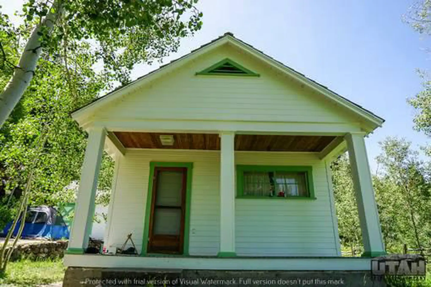
Cabin and lookout rentals nearby
On the National Register nearby
- Santaquin Junior High SchoolBuilding · Santaquin · 4.6 mi
- Payson Presbyterian ChurchBuilding · Payson · 5.9 mi
- Peteetneet SchoolBuilding · Payson · 6.3 mi
Natural features
White fir, Pinyon Pine and Gambel Oak grow in an open forest that provides shade and shelter for sites.
Recreation
Rainbow and brook trout fishing is popular in the creek below the campground. Canoeing, floating and kayaking are enjoyed on the calm waters of Maple Lake. Red Lake Trail leaves from the upper camping areas by the lake.
Nearby
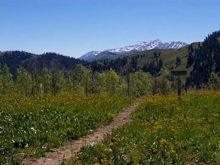
The Mount Nebo Wilderness Area is adjacent, brimming with beautiful mountain scenery, pristine waters, abundant wildlife, vibrant wildflowers and numerous trail opportunities. The Nebo Loop Scenic Byway stretches 37 miles through high alpine terrain, dense forests and colorful meadows. Devils Kitchen Geological Area can be found along the loop. It offers a 1/2 mile round trip trail to interesting red rock hoodoos.
Guidebooks for Utah
We earn a small commission if you buy through these links. It does not change what we list.


Titles come from Open Library's catalog, matched by subject heading or by title.
Reference
Questions people ask
Do I need a reservation at Maple Lake Campground?
Sites at Maple Lake Campground are reservable on Recreation.gov. Any walk-up sites are listed on the booking page.
Source: Recreation.gov
How much does it cost to camp at Maple Lake Campground?
Cash, Check, or Scan & Pay (with recreation.gov app). 10 single sites- $29.00, capacity 8 people + 1 vehicle. Day Use in a campground site - $15.00.
Source: Recreation.gov
What time is check-in at Maple Lake Campground?
Check-in 03:00 PM, checkout 12:00 PM.
Source: Recreation.gov
What does it cost to cancel a reservation at Maple Lake Campground?
A $10 service fee will be withheld from any refund for a cancellation.
Source: Charges and cancellations
Is Maple Lake Campground open right now?
Closed for the season as of Oct 16, 2026.
Source: Forest Service status
How many sites does Maple Lake Campground have?
11 sites, including 10 standard sites without power.
Source: Recreation.gov
Can I bring an RV to Maple Lake Campground?
Maple Lake Campground is listed for tents only.
Source: Recreation.gov
Are pets allowed at Maple Lake Campground?
Yes, pets are allowed at Maple Lake Campground. Leash rules apply.
Source: Recreation.gov
Can I have a campfire at Maple Lake Campground?
Fires are allowed in the provided rings under normal conditions. As of 2026-10-16, there are 4 active fires within 50 miles, so check current restrictions before you light one. 16 day stay limit.
Source: Fire nearby
Is there cell service at Maple Lake Campground?
FCC coverage maps show Verizon 4G LTE, AT&T 4G LTE, and T-Mobile 5G at the campground point. Terrain changes that from one site to the next.
Source: FCC Broadband Map
What is there to do at Maple Lake Campground?
Rainbow and brook trout fishing is popular in the creek below the campground. The Recreation section on this page has the rest.
Source: Recreation
What is the nearest town to Maple Lake Campground?
Payson, Utah. The Mount Nebo Wilderness Area is adjacent, brimming with beautiful mountain scenery, pristine waters, abundant wildlife, vibrant wildflowers and numerous trail opportunities.
Source: Getting there