Riggs Lake
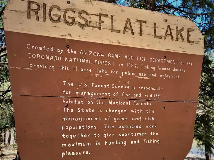
Riggs Flat Lake is located at the end of Swift Trail, a road that winds along the top of the Pinaleno Mountains. It is a small picturesque lake, 11 acres in size, set in alpine forest and meadow. Its cold waters are stocked during the summer with rainbow, brown and brook trout, and anglers report that the fishing is usually good. Best baits for the rainbows are corn, cheese, garlic cheese, salmon eggs, and worms. The brown and brook trout are taken on artificial lures and flies as well. Small boats are permitted on the lake, but most people fish from the shoreline. If the big ones aren’t biting, there is always plenty of scenery to enjoy.
More like this: reservable in Arizona · big rigs in Arizona · tent only in Arizona · pets allowed in Arizona · group sites in Arizona
Check availability on Recreation.gov ↗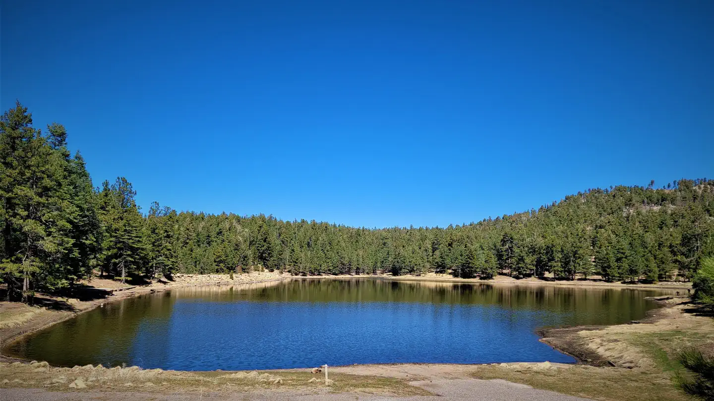
Site mix
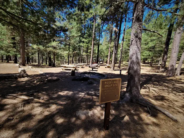
| Group sites | 1 |
Amenities & rules
| Max vehicle length | 40 ft |
| Equipment | Tents |
| Pets | Allowed |
Nearest first aid - Mt. Graham Community Hospital in Safford. Boat ramp, fee charged for some activities, picnic tables, toilets, parking
Individual sites vary. Confirm on Recreation.gov or with the managing office.
Weather by month
Getting there
From Safford, drive south 8 miles on US 191 to AZ 366. Turn right (southwest) onto 366 and drive 29 miles to the Columbine Work Center. Continue along Forest Roads 803 and 287 about 5 miles to the campground. The last 12 miles of this road are narrow and winding.
| Coordinates | 32.7085° N, 109.9623° W · Directions ↗ |
Supplies & services
| Outdoor gear | Gila Outdoor ↗ | 15.2 mi |
| RV sales & service | Trek RV ↗ | 17.4 mi |
Locations © OpenStreetMap contributors. Call ahead; hours change seasonally.
Explore
Trails nearby
- 0.3 miLakeshore Trail #3400.7 mi trail · hiking, horse, bike
- 0.3 miJesus Babcock1.1 mi trail · hiking, horse, bike
- 0.6 miJesus Goudy Ridge ↗4.9 mi trail · hiking, horse, bike
- 0.8 miHell'S Hole2.7 mi trail · hiking, horse, bike
- 1.1 miClark Peak ↗5.7 mi trail · hiking, horse, bike
- 1.4 miBlair Canyon ↗5 mi trail · hiking, horse, bike
Trailheads within three miles
- 2.8 miColumbine Corrals Trailhead ↗Coronado National Forest
Trail and trailhead records are the Forest Service's. Distances are straight-line to the nearer trail end. Trail conditions are not tracked here.
Other campgrounds nearby


On the National Register nearby
- Webb Peak Lookout TowerStructure · Old Columbine · 2.3 mi
- Columbine Work StationBuilding · Safford · 2.9 mi
- West Peak Lookout TowerStructure · Bonita · 4.9 mi
Recreation
Day use: A Coronado National Forest or Interagency (America the Beautiful) pass must be displayed. Day use passes can be purchased at the site for $8. For visitors who do not want to use facilities, there is a small fee-free parking area outside of the campground. A valid Arizona fishing license and trout stamp (available at outdoor stores around the state) is required for all anglers 14 years of age and older. Six trout is the daily limit and the possession limit. Using live bait fish is prohibited. Fishing season is May to October, day and night. Boats are permitted on the lake, but only single electric motors may be used.
Guidebooks for Arizona
We earn a small commission if you buy through these links. It does not change what we list.
- Best Backpacking Trips in Utah, Arizona, and New MexicoMike White and Douglas Lorain, 2016Find at Bookshop.org
Titles come from Open Library's catalog, matched by subject heading or by title.
Reference
Questions people ask
Do I need a reservation at Riggs Lake?
Sites at Riggs Lake are reservable on Recreation.gov. Any walk-up sites are listed on the booking page.
Source: Recreation.gov
How many sites does Riggs Lake have?
1 site, including 1 group site.
Source: Recreation.gov
Will my RV fit at Riggs Lake?
The longest site here provides 40 feet of vehicle capacity. Most sites are shorter. The sidebar tool checks a trailer or motorhome length against every site.
Source: Will my RV fit
Are pets allowed at Riggs Lake?
Yes, pets are allowed at Riggs Lake. Leash rules apply.
Source: Recreation.gov
What is there to do at Riggs Lake?
Day use: A Coronado National Forest or Interagency (America the Beautiful) pass must be displayed. The Recreation section on this page has the rest.
Source: Recreation
What if Riggs Lake is full?
The nearest public campgrounds are Riggs Flat Campground (under 0.1 mi, partly first-come), Soldier Creek Campground (2.5 mi, first-come), and Columbine Corrals Campground (2.8 mi, first-come).
Source: Campgrounds nearby